 |
|
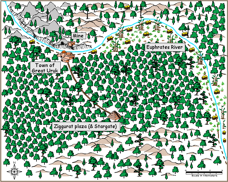 The area surrounding the Stargate, and most of the way to the river, is wooded and fairly open, without a lot of underbrush. About seven kilometers north of the Stargate (and looping around to the east) there's a river, which the inhabitants call the Euphrates. The largest known settlement, Great Uruk, a town of several hundred inhabitants, is spread along the southern bank of the river. At this point the river is quite rapid, and the northern side is a cliff around fifty meters high. It is crossed by boat, and then there's a switchback path leading up to the top of the cliff and the buildings there. The land along the river slopes up to the west and down to the east, until north and east of the Stargate the river becomes much more broad and placid. Farming and fishing communities have villages dotted along the south bank of the river to the east of Great Uruk.
|
Map of the area around the Stargate | Map of the area from the Stargate to the mine | Language and writing on Uruk |